Washington by road: Oceans, forts, volcanoes, and more
The last few days of my Homeland Holiday was road trip time! Daddy and I set out for a tour around Washington State where we took in various ocean views, military forts, volcanoes, and much, much more.
We didn’t really have a plan for the trip, just a general direction of travel with a single “must-stop” venue. Everything else was figured out as we went – from hotels to meals and everything in between. It’s a gamble to travel that way, but we were prepared to sleep in the car if it came down to it.
And I think it’s fair to say that our gamble paid off. And much fun was had!
Warning: This is a long post. If you just want to see the photos, you can click here to go straight to the gallery.
Day 1: Cle Elum to Port Angeles and beyond
We set off in the morning after loading up the car. The first leg of the journey was travelling across Snoqualmie Pass via I-90 before connecting with WA-18 to I-5. From I-5, we drove across the Tacoma Narrows (WA-16 to WA-3) to our first stop: Silverdale. This was merely a function stop so that I could get cash from my credit union and for a facility break (with a light snack in the carpark). Then it was back to WA-3 northbound before crossing the Hood Canal Floating Bridge on WA-104.
The remaining stops for the day were fun stops beginning with a slight detour from WA-104 to Ludlow on WA-19. We stopped at Ludlow Falls for a short walk (0.77 miles) and a couple of geocaches. You can’t have a road trip without geocaches!!
Our next stop was Sequim along US-101. There is a bike shop there that sells recumbent trikes, and Daddy is in the (theoretical) market for a new one to add to his collection. He didn’t make a purchase, but I think he enjoyed looking!
We continued on US-101 through Port Angeles to connect with WA-112 on our way to Camp Hayden to see the gun placements (or, as Dad correctly pointed out, the gun emplacement) from WWII. The weather was a little drizzly at this point, but not so much that we were put off the adventure.
We walked about 2 miles around the old military camp and Salt Creek Recreation Area, as it’s now known. There were a few different military “sites”, including old weapon stores and lookouts, as well as a series of scenic lookout points (which would have been military lookouts “back in the day”). I was a little surprised that they didn’t make more of the WWII history at the site. Instead, it’s a nice family campground with some easy walking trails that include disused military installations. (If I ran the world, there would be an audio walking tour that gave a range of information from military to natural to native populations to current day use. But I am not in charge. So…)

Finally, it was time to find a room for the night, so we made our way back to Port Angeles where (after some Googling) we found a comfy place to stay. We also used Google to find a diner that served breakfast, as Dad had a hankering for a Denver omelette. And, I must say, the meal at Jashua’s was a great success! [See my review here.]
After dinner, we drove out to Ediz Hook (a 3-mile sand spit) where we enjoyed watching the sun go down – and I grabbed another 2 geocaches. Then it was back to our “home” for the night so that we could rest up for Day 2.
Daily miles: 260.9 /// Daily geocaches: 4
Day 2: Port Angeles to Aberdeen and lots of living
On Day 2, we set off from Port Angeles on US-101 towards Lake Crescent so that we could visit Marymere Falls. There is a nice little trail that took us straight there, with a small loop near the falls that allowed us to enjoy views from a couple of different elevations. The 2.75-mile walk was fairly gentle, although the loop section was quite steep with several stairs to climb. But absolutely worth it!
Had I been on my own – or with someone closer to my own fitness levels – I would have made the climb up Storm King Mountain, too. But whilst I knew Daddy would have waiting for me, I also know that I would have felt quite rushed and wouldn’t have enjoyed it knowing I was holding up the show. So, a summit to conquer another day!
As we drove further along US-101, I looked at a guide we picked up the day before for inspiration. And we were inspired by La Push so we veered off the highway just before Forks and took WA-110 across to the coastline to explore La Push a bit. There, we walked down to the beach to take some photos, resisting the urge to walk along the breakwater because it was too uneven – especially given the strong winds. Instead, we explored La Push a bit more and were treated to a wonderful view of a bald eagle sitting in a tree.
After leaving La Push, we drove back to US-101 and into the Town of Forks. (No, we didn’t see any vampires or werewolves… that we know of. But I did find two geocaches.) We stopped for a picnic lunch in a local park before finding a public convenience to ready ourselves for the next leg of the journey. If I was a fan of Twilight or even knew more about it than “vampires and werewolves”, I might have suggested exploring a bit. But there were more enticing things further along the road, so we kept going.
The next stop on our journey was Kalaloch, where Mum spent many childhood summers camping with her family. It is also where my folks went on their camping and road trip honeymoon more than 50 years ago. So, it holds a special place in my heart (and in Dad’s, I’m sure) as it’s part of our family story.
One of the reasons we stopped was because Daddy wanted to see the Tree of Life that lives and thrives on the edge of the dunes. I was pleased to see so many people admiring the strength of nature and even more pleased at the lack of obvious litter and human destruction. Whilst people were stopping to look at take photos, no one was climbing into the root structure for photo opportunities.

Maybe people can see the fragility of the tree and realise that its life is more important than likes. Or maybe we just visited on a good day. Who knows.
As we left the beach, I found a lovely grey and white striped pebble. The colouring and size are perfect for having made into a ring or a pendant. So, I’ll have to find a jewellery maker when I get back to Scotland.
On leaving Kalaloch, we considered a few different options for the night in nearby communities, but there were no vacancies at the close-to-hand options. However, I had plenty of energy left so I took the wheel and drove us south to Aberdeen for the night.
We got to Aberdeen in time to settle into our digs for the evening before heading out for some grub. As Daddy chose dinner the night before, it was my turn for decision-making – so we Googled good places for Ruben sandwiches. There were a couple of options, but we chose Billy’s Bar & Grill. And it was a good choice, too. The sandwiches were just what I wanted, and the fries were really nice. So, a winner!
Daily miles: 197.9 /// Daily geocaches: 2
Day 3: Aberdeen to Kalama and a family reunion
We started Day 3 with a which-way plan because my cousin’s daughter reached out to see if we’d be able to visit her and her family on our travels. So, I popped her a message on the way out the door to see if we could get something planned. Then we made our way to the Gray’s Harbor Public Viewpoint Tower to take in the views. However, it was a bit disappointing as it was neither a tower nor a view. However one should never pass up the opportunity – just in case.
From there, we found our way back to US-101 and continued south to Fort Columbia – the primary inspiration for the road trip, based on a random conversation about tidal causeways and islands and old military bases. (Those are normal conversations between a grown woman and her father, right?)
I was impressed with the fort from the moment we drove into the site. Between the original fort buildings and the acres and acres of old military bunkers, lookouts, and guns, I was in Big Kid Heaven! We spent a couple of hours walking around the site, going into the various bunker and artillery buildings, before visiting the old barracks building which houses the interpretive centre. We also walked down to the water and looked around at some of the old store buildings there, as well as old pier pillars. Oh, and I grabbed two geocaches on the site. Because, why not?
The site was so big and there was such a range of interesting things that we couldn’t see everything. But it is certainly on my list of places to return to. And maybe I’ll even treat myself to a stay at one of the old fort buildings, as a couple of them are let out as vacation rentals now.
Leaving the fort, we returned to US-101 and crossed into Oregon across the Astoria-Megler Bridge. Then we followed US-30 eastbound to WA-433 towards Longview, Washington, before crossing over to I-5 southbound.
The next bit of the journey was the “which-way-and-when” part. That’s because we kind of knew where we wanted to be, but my cousin was in work meetings so we couldn’t really make plans beyond knowing we would meet up at some point in the next couple of hours.
So, we went to Google again to find hotels in the general vicinity and landed on a place in Kalama – not too terribly far from my cousin’s home in La Center. And that’s where the phone-tagging came into force. Or, rather, message-tagging!
We made our way to La Center to explore a bit before meeting up at a local park – and stopped at the local farmer’s market for some lovely Rainier cherries along the way. And then we went to meet The Kid – who is my cousin’s daughter’s son which, according to the charts, makes him my First Cousin Twice Removed (or more simply, my cousin).
And the best part (other than the baby cuddles) is that I am the first one of my sisters to meet him! Even though I live the furthest away, I am the one who got to make cooing sounds and dote over the little man before the others. And that makes me very happy. (No photo here, as he’s not my kid. If you know the family, you’ll know how to meet the kid and/or to find photos.)
After catching up with everyone, Daddy and I made our way back to Kalama whilst they made their way home. The plan was to eat dinner at the McMenamins Pub at Kalama Harbor, but they were very busy, and it was so noisy, that we decided to find somewhere else. We took to Google once again and found a place called The Burger Bar. It looked like an old-fashioned drive-in and the menu was basic. Very basic. Which is a good sign for a burger bar. And it was delicious! [See my review here.]
After dinner, I walked back to the hotel to get the last of my 10,000 steps for the day. (It wasn’t that far.) Then we looked at the map and planned for the next day’s travels. Mt St Helens, here we come!
Daily miles: 197.3 /// Daily geocaches: 4
Day 4: Kalama to Cle Elum by way of volcanoes
Day 4 was our final day – and the longest by far (in both miles and time). But it was a blast! (Although not a literal blast; the last time that happened was more than 40 years ago.)
We set off from Kalama early with me behind the wheel, heading northbound along I-5 towards US-12. From there, we made the drive eastbound to Randle where Daddy took over the driving. And it’s a good thing, as I might have turned around where he kept going… even when we knew we were on the “wrong” road. (But we did know it would take us to our destination.)
When we looked at the paper map the night before, we planned to drive to Randle on US-12 and then drop south on WA-131 before taking NFD-25 to NF-99 for the drive to Windy Ridge Viewpoint. But where WA-131 turned to the forest service road, Missy (what Dad calls his Google Maps) told us to take a right onto NF-26 – a much narrower, sketchier road. I immediately questioned this, and we stopped to consider it for a bit… but then decided to carry on along NF-26.
Well, let’s just say that NF-26 is no longer maintained and won’t be passable after another couple of hard winters without maintenance. The further in we got, the worse it got. But then it got better as we neared the junction with the nicely maintained NF-99.
But the wrong road was amazing! We had plenty of gas and food so weren’t worried about that. And we got to see views that most people won’t get to enjoy. And! And! It meant that we “found” Ryan Lake! After Mt St Helens erupted, the lake was left un-reclaimed. Instead, it is now a wildlife refuge and a place of research. That means that there isn’t a wonderful “tourist” view, but I like the idea of my lake being of scientific interest. And maybe one day, I’ll go back for some hiking and camping around the site.
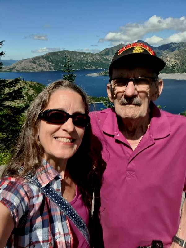
When we eventually made it to Windy Ridge, we took in the scenery from the lower viewpoint (and carpark) then I made my way to the 368-step sand ladder to climb to the higher viewpoint (about a quarter of a mile up the hill). I kept a brisk pace on the climb but stopped a couple of times for photos of flowers. At the viewpoint, I enjoyed vistas overlooking Spirit Lake and the debris-filled north of the volcano. Then I made my way back down the hill where Daddy was waiting for me. I also logged a “virtual” geocaches at the viewpoint which was nice.

On the way out of Mt St Helens and back to Randle, we ignored Missy in favour of the road we’d intended to take in the first place. You could certainly tell the difference between the two roads – in part because one of them is maintained, but also because we weren’t the only car on the road! It was also a much faster journey.
At the US-12 Randle junction, we travelled east to WA-123 to drive over Chinook Pass to Cayuse Pass on WA-410. We stopped at Tipsoo Lake in Mt Rainier National Park along the way – where I enjoyed some Rainier cherries. From there, I was back in the driver’s seat for the rest of the journey.
Driving further along WA-410 towards Yakima, we stopped at Salmon Falls and the Ladder of Hope – a regular stop for Dad and part of a day trip we did the summer before. Then we drove into Yakima and Union Gap to pick up a couple of things before heading eastbound on I-82 to I-90 at Ellensburg for the final leg home to Cle Elum.
Once we got to Cle Elum, we stopped at Subway for sandwiches then home to eat and relax before I unloaded the car. It was certainly a long day, but a really good one, too.
Daily miles: 338.3 /// Daily geocaches: 1
Total miles: 994.5 /// Total geocaches: 11
It was a really great road trip, I would have liked to do a lot more of the driving. But I imagine that Daddy would have liked to do a lot more of the driving, too. That’s what happens when you put two people who love to drive in a car together. (However, I did my fair share, and I am happy with that.)
And I’m not sure if we’ll get another road trip in for this visit, as we have so many other things to do. But I know that there will be plenty of fun in the coming days and weeks.
Now that we’re back from our road trip, it’s time for me to lace up my running shoes… and get busy with my long list of chores.


Discover more from Just Frances
Subscribe to get the latest posts sent to your email.